Difference between revisions of "dfw-toll-road-toll-map"
Aditya-mapup (talk | contribs) |
|||
| Line 31: | Line 31: | ||
== Dallas North Tollway or DNT == | == Dallas North Tollway or DNT == | ||
<div style="text-align: center;"> | <div style="text-align: center;"> | ||
| − | <html><figure class="aligncenter size-full is-resized"><img alt="Toll booth locations on Dallas North Tollway between Dallas, Collin and Denton through Highland Park and University Park" class="wp-image-8855" height="565" loading="lazy" sizes="(max-width: 563px) 100vw, 563px" src="https://cms. | + | <html><figure class="aligncenter size-full is-resized"><img alt="Toll booth locations on Dallas North Tollway between Dallas, Collin and Denton through Highland Park and University Park" class="wp-image-8855" height="565" loading="lazy" sizes="(max-width: 563px) 100vw, 563px" src="https://cms.ec2.mapup.ai/wp-content/uploads/2021/01/Dallas-North-Tollway-DNT-Toll-Map.jpg" srcset="https://cms.ec2.mapup.ai/wp-content/uploads/2021/01/Dallas-North-Tollway-DNT-Toll-Map.jpg 1126w, https://cms.ec2.mapup.ai/wp-content/uploads/2021/01/Dallas-North-Tollway-DNT-Toll-Map-498x500.jpg 498w, https://cms.ec2.mapup.ai/wp-content/uploads/2021/01/Dallas-North-Tollway-DNT-Toll-Map-1020x1024.jpg 1020w, https://cms.ec2.mapup.ai/wp-content/uploads/2021/01/Dallas-North-Tollway-DNT-Toll-Map-768x771.jpg 768w" width="563"/><figcaption>Toll booths of Dallas North Tollway (DNT), Texas</figcaption></figure></html> |
</div> | </div> | ||
The Dallas North Tollway is a 30.2-mile limited-access toll road operated by the North Texas Tollway Authority (NTTA), which runs from Interstate 35E near downtown Dallas, Texas, to the U.S. Highway 380, in Frisco, Texas. This expressway connects motorists travelling between downtown Dallas and cities in Collin, Denton and northern Dallas counties passing through Highland Park, University Park, Addison, Farmers Branch, Plano and Frisco. | The Dallas North Tollway is a 30.2-mile limited-access toll road operated by the North Texas Tollway Authority (NTTA), which runs from Interstate 35E near downtown Dallas, Texas, to the U.S. Highway 380, in Frisco, Texas. This expressway connects motorists travelling between downtown Dallas and cities in Collin, Denton and northern Dallas counties passing through Highland Park, University Park, Addison, Farmers Branch, Plano and Frisco. | ||
| Line 96: | Line 96: | ||
== DFW International Parkway == | == DFW International Parkway == | ||
<div style="text-align: center;"> | <div style="text-align: center;"> | ||
| − | <html><figure class="aligncenter size-full is-resized"><img alt="Toll booth locations on International Parkway leading to DFW International Airport from the Dallas-Fort Worth Metroplex" class="wp-image-8866" height="297" loading="lazy" sizes="(max-width: 563px) 100vw, 563px" src="https://cms. | + | <html><figure class="aligncenter size-full is-resized"><img alt="Toll booth locations on International Parkway leading to DFW International Airport from the Dallas-Fort Worth Metroplex" class="wp-image-8866" height="297" loading="lazy" sizes="(max-width: 563px) 100vw, 563px" src="https://cms.ec2.mapup.ai/wp-content/uploads/2021/01/International-Parkway-Toll-Map-DFW-Airport-Toll-Booths.jpg" srcset="https://cms.ec2.mapup.ai/wp-content/uploads/2021/01/International-Parkway-Toll-Map-DFW-Airport-Toll-Booths-640x339.jpg 640w, https://cms.ec2.mapup.ai/wp-content/uploads/2021/01/International-Parkway-Toll-Map-DFW-Airport-Toll-Booths-768x407.jpg 768w" width="563"/><figcaption>Toll booths of International Parkway, Texas</figcaption></figure></html> |
</div> | </div> | ||
International Parkway provides access to Dallas/Fort Worth International Airport<ref>[https://en.wikipedia.org/wiki/Dallas/Fort_Worth_International_Airport Dallas/Fort Worth International Airport]</ref> (DFW) from the metropolitan area in the Dallas-Fort Worth Metroplex<ref>[https://en.wikipedia.org/wiki/Dallas-Fort_Worth_Metroplex Dallas-Fort Worth Metroplex]</ref>. The DFW Airport toll plaza also handles parking fees for the DFW airport so consequently, you have to pay a toll to get to DFW airport. | International Parkway provides access to Dallas/Fort Worth International Airport<ref>[https://en.wikipedia.org/wiki/Dallas/Fort_Worth_International_Airport Dallas/Fort Worth International Airport]</ref> (DFW) from the metropolitan area in the Dallas-Fort Worth Metroplex<ref>[https://en.wikipedia.org/wiki/Dallas-Fort_Worth_Metroplex Dallas-Fort Worth Metroplex]</ref>. The DFW Airport toll plaza also handles parking fees for the DFW airport so consequently, you have to pay a toll to get to DFW airport. | ||
| Line 136: | Line 136: | ||
== President George Bush Turnpike or PGBT == | == President George Bush Turnpike or PGBT == | ||
<div style="text-align: center;"> | <div style="text-align: center;"> | ||
| − | <html><figure class="aligncenter size-full is-resized"><img alt="Toll booth locations on George Bush Turnpike, Texas leading to DFW International Airport, I635 and Interstate 35E" class="wp-image-8856" height="370" loading="lazy" sizes="(max-width: 563px) 100vw, 563px" src="https://cms. | + | <html><figure class="aligncenter size-full is-resized"><img alt="Toll booth locations on George Bush Turnpike, Texas leading to DFW International Airport, I635 and Interstate 35E" class="wp-image-8856" height="370" loading="lazy" sizes="(max-width: 563px) 100vw, 563px" src="https://cms.ec2.mapup.ai/wp-content/uploads/2021/01/George-Bush-Turnpike-Map-PGBT-Toll-Map.jpg" srcset="https://cms.ec2.mapup.ai/wp-content/uploads/2021/01/George-Bush-Turnpike-Map-PGBT-Toll-Map.jpg 1126w, https://cms.ec2.mapup.ai/wp-content/uploads/2021/01/George-Bush-Turnpike-Map-PGBT-Toll-Map-640x421.jpg 640w, https://cms.ec2.mapup.ai/wp-content/uploads/2021/01/George-Bush-Turnpike-Map-PGBT-Toll-Map-768x505.jpg 768w" width="563"/><figcaption>Toll booths of President George Bush Turnpike (PGBT), Texas</figcaption></figure></html> |
</div> | </div> | ||
The President George Bush Turnpike, operated by the North Texas Tollway Authority (NTTA), is a 52-mile, limited access expressway that forms a partial loop around the northern Dallas-Fort Worth Metroplex. It gives motorists additional access to US 75, the Dallas North Tollway, Interstate 35E, I-635 and Dallas/Fort Worth International Airport as well. | The President George Bush Turnpike, operated by the North Texas Tollway Authority (NTTA), is a 52-mile, limited access expressway that forms a partial loop around the northern Dallas-Fort Worth Metroplex. It gives motorists additional access to US 75, the Dallas North Tollway, Interstate 35E, I-635 and Dallas/Fort Worth International Airport as well. | ||
| Line 145: | Line 145: | ||
== President George Bush Turnpike-Western Extension or PGBT-WE == | == President George Bush Turnpike-Western Extension or PGBT-WE == | ||
<div style="text-align: center;"> | <div style="text-align: center;"> | ||
| − | <html><figure class="aligncenter size-full is-resized"><img alt="Toll booth locations on Western Extension of PGBT or Texas 161 between SH 183, I 30 and I 20 through Irving and Grand Prairie" class="wp-image-8857" height="584" loading="lazy" sizes="(max-width: 560px) 100vw, 563px" src="https://cms. | + | <html><figure class="aligncenter size-full is-resized"><img alt="Toll booth locations on Western Extension of PGBT or Texas 161 between SH 183, I 30 and I 20 through Irving and Grand Prairie" class="wp-image-8857" height="584" loading="lazy" sizes="(max-width: 560px) 100vw, 563px" src="https://cms.ec2.mapup.ai/wp-content/uploads/2021/01/PGBT-WE-President-George-Bush-Western-Extension-Turnpike-Toll-Map.jpg" srcset="https://cms.ec2.mapup.ai/wp-content/uploads/2021/01/PGBT-WE-President-George-Bush-Western-Extension-Turnpike-Toll-Map-481x500.jpg 481w, https://cms.ec2.mapup.ai/wp-content/uploads/2021/01/PGBT-WE-President-George-Bush-Western-Extension-Turnpike-Toll-Map-985x1024.jpg 985w" width="560"/><figcaption>Toll booths of President George Bush Turnpike Western Extension (PGBT – WE), Texas</figcaption></figure></html> |
</div> | </div> | ||
The western extension of President George Bush Turnpike provides an 11.5-mile link between SH 183, I-30, and I-20. The corridor consists of the tolled (cashless) main lanes, known as the Western Extension, and the frontage roads, called the State Highway (SH) 161. It is a part of the western loop around Dallas through Irving and Grand Prairie, just south of Dallas-Fort Worth (DFW) International Airport. | The western extension of President George Bush Turnpike provides an 11.5-mile link between SH 183, I-30, and I-20. The corridor consists of the tolled (cashless) main lanes, known as the Western Extension, and the frontage roads, called the State Highway (SH) 161. It is a part of the western loop around Dallas through Irving and Grand Prairie, just south of Dallas-Fort Worth (DFW) International Airport. | ||
| Line 155: | Line 155: | ||
== President George Bush Turnpike-Eastern Extension or PGBT-EE == | == President George Bush Turnpike-Eastern Extension or PGBT-EE == | ||
<div style="text-align: center;"> | <div style="text-align: center;"> | ||
| − | <html><figure class="aligncenter size-full is-resized"><img alt="Toll booth locations on Eastern Extension of PGBT between northwest Garland to Interstate 30" class="wp-image-8858" height="295" loading="lazy" src="https://cms. | + | <html><figure class="aligncenter size-full is-resized"><img alt="Toll booth locations on Eastern Extension of PGBT between northwest Garland to Interstate 30" class="wp-image-8858" height="295" loading="lazy" src="https://cms.ec2.mapup.ai/wp-content/uploads/2021/01/PGBT-EE-President-George-Bush-Eastern-Extension-Turnpike-Toll-Map.jpg" width="563"/><figcaption>Toll booths of President George Bush Turnpike Eastern Extension (PGBT – EE), Texas</figcaption></figure></html> |
</div> | </div> | ||
The Eastern Extension of the President George Bush Turnpike is a portion of the outer loop around Dallas and its suburbs that extends from northwest Garland to Interstate 30. It is part of the Loop 9 or the State Highway (SH) 190 corridor. | The Eastern Extension of the President George Bush Turnpike is a portion of the outer loop around Dallas and its suburbs that extends from northwest Garland to Interstate 30. It is part of the Loop 9 or the State Highway (SH) 190 corridor. | ||
| Line 165: | Line 165: | ||
== Sam Rayburn Tollway or SRT == | == Sam Rayburn Tollway or SRT == | ||
<div style="text-align: center;"> | <div style="text-align: center;"> | ||
| − | <html><figure class="aligncenter size-full is-resized"><img alt="Toll booth locations on Sam Rayburn Tollway or Texas 121 or State Highway 121 between Grapevine to McKinney" class="wp-image-8859" height="424" loading="lazy" sizes="(max-width: 563px) 100vw, 563px" src="https://cms. | + | <html><figure class="aligncenter size-full is-resized"><img alt="Toll booth locations on Sam Rayburn Tollway or Texas 121 or State Highway 121 between Grapevine to McKinney" class="wp-image-8859" height="424" loading="lazy" sizes="(max-width: 563px) 100vw, 563px" src="https://cms.ec2.mapup.ai/wp-content/uploads/2021/01/Sam-Rayburn-Tollway-Toll-Booths-Texas-121-Toll-Map.jpg" srcset="https://cms.ec2.mapup.ai/wp-content/uploads/2021/01/Sam-Rayburn-Tollway-Toll-Booths-Texas-121-Toll-Map.jpg 1126w, https://cms.ec2.mapup.ai/wp-content/uploads/2021/01/Sam-Rayburn-Tollway-Toll-Booths-Texas-121-Toll-Map-640x483.jpg 640w, https://cms.ec2.mapup.ai/wp-content/uploads/2021/01/Sam-Rayburn-Tollway-Toll-Booths-Texas-121-Toll-Map-768x580.jpg 768w" width="563"/><figcaption>Toll booths of Sam Rayburn Tollway (SRT), Texas</figcaption></figure></html> |
</div> | </div> | ||
Sam Rayburn Tollway, a part of North Texas Tollway Authority (NTTA), runs from Grapevine to McKinney including the direct connector ramps at US 75, Dallas North Tollway, and I-35E. It was formerly known as State Highway (SH) 121, 121 Tollway or Texas 121 toll road. | Sam Rayburn Tollway, a part of North Texas Tollway Authority (NTTA), runs from Grapevine to McKinney including the direct connector ramps at US 75, Dallas North Tollway, and I-35E. It was formerly known as State Highway (SH) 121, 121 Tollway or Texas 121 toll road. | ||
| Line 174: | Line 174: | ||
== Chisholm Trail Parkway or CTP == | == Chisholm Trail Parkway or CTP == | ||
<div style="text-align: center;"> | <div style="text-align: center;"> | ||
| − | <html><figure class="aligncenter size-full is-resized"><img alt="Toll booth locations on Chisholm Trail Parkway between downtown Fort Worth south and Cleburne including Burleson" class="wp-image-8860" height="591" loading="lazy" src="https://cms. | + | <html><figure class="aligncenter size-full is-resized"><img alt="Toll booth locations on Chisholm Trail Parkway between downtown Fort Worth south and Cleburne including Burleson" class="wp-image-8860" height="591" loading="lazy" src="https://cms.ec2.mapup.ai/wp-content/uploads/2021/01/Chisholm-Trail-Toll-Road-Map-CTP-Toll-Map.jpg" width="563"/><figcaption>Toll booths of Chisholm Trail Parkway (CTP), Texas</figcaption></figure></html> |
</div> | </div> | ||
The Chisholm Trail Parkway is a 27.6-mile toll road extending from downtown Fort Worth south to Cleburne including Burleson. The entry and/or exit of the Chisholm Trail Parkway are at the following locations: | The Chisholm Trail Parkway is a 27.6-mile toll road extending from downtown Fort Worth south to Cleburne including Burleson. The entry and/or exit of the Chisholm Trail Parkway are at the following locations: | ||
| Line 191: | Line 191: | ||
== Addison Airport Toll Road Tunnel or AATP == | == Addison Airport Toll Road Tunnel or AATP == | ||
<div style="text-align: center;"> | <div style="text-align: center;"> | ||
| − | <html><figure class="aligncenter size-full is-resized"><img alt="Toll booth locations on Addison Airport Toll Tunnel (AATT) between Dallas North Tollway and I-35E under the Addison Airport runway" class="wp-image-8861" height="308" loading="lazy" src="https://cms. | + | <html><figure class="aligncenter size-full is-resized"><img alt="Toll booth locations on Addison Airport Toll Tunnel (AATT) between Dallas North Tollway and I-35E under the Addison Airport runway" class="wp-image-8861" height="308" loading="lazy" src="https://cms.ec2.mapup.ai/wp-content/uploads/2021/01/Addison-Airport-Toll-Road-Tunnel-AATT-Toll-Map.jpg" width="563"/><figcaption>Toll booths of Addison Airport Toll Road Tunnel (AATT), Texas</figcaption></figure></html> |
</div> | </div> | ||
The Addison Airport Toll Tunnel (AATT) serves as an east-west route between the Dallas North Tollway and I-35E under the Addison Airport runway. The tunnel provides a passage on Keller Springs Road, which once ended on either side of Addison Airport, as an alternative to Belt Line Road or Trinity Mills Road. <br/><br/>TheAddison Airport toll road tunnel cost<ref>[https://www.ntta.org/roadsprojects/rates/Pages/Toll-Rate-Charts.aspx#AdissionTUnnelSection Addison Airport toll road tunnel cost]</ref> varies for bikes, cars and other vehicles depending on their axle counts and mode of payment (whether through tag transponders or ZipCash). Tag transponders accepted on AATT are TollTag, EZ TAG, TxTag, PikePass or K-TAG. | The Addison Airport Toll Tunnel (AATT) serves as an east-west route between the Dallas North Tollway and I-35E under the Addison Airport runway. The tunnel provides a passage on Keller Springs Road, which once ended on either side of Addison Airport, as an alternative to Belt Line Road or Trinity Mills Road. <br/><br/>TheAddison Airport toll road tunnel cost<ref>[https://www.ntta.org/roadsprojects/rates/Pages/Toll-Rate-Charts.aspx#AdissionTUnnelSection Addison Airport toll road tunnel cost]</ref> varies for bikes, cars and other vehicles depending on their axle counts and mode of payment (whether through tag transponders or ZipCash). Tag transponders accepted on AATT are TollTag, EZ TAG, TxTag, PikePass or K-TAG. | ||
| Line 198: | Line 198: | ||
== Mountain Creek Lake Toll Bridge or MCLB == | == Mountain Creek Lake Toll Bridge or MCLB == | ||
<div style="text-align: center;"> | <div style="text-align: center;"> | ||
| − | <html><figure class="aligncenter size-full is-resized"><img alt="Toll booth locations on Mountain Creek Lake Toll Bridge (MCLB) between Oak Cliff section, Dallas and the Grand Prairie" class="wp-image-8864" height="311" loading="lazy" sizes="(max-width: 563px) 100vw, 563px" src="https://cms. | + | <html><figure class="aligncenter size-full is-resized"><img alt="Toll booth locations on Mountain Creek Lake Toll Bridge (MCLB) between Oak Cliff section, Dallas and the Grand Prairie" class="wp-image-8864" height="311" loading="lazy" sizes="(max-width: 563px) 100vw, 563px" src="https://cms.ec2.mapup.ai/wp-content/uploads/2021/01/Mountain-Creek-Lake-Toll-Bridge-MCLB-Toll-Map.jpg" srcset="https://cms.ec2.mapup.ai/wp-content/uploads/2021/01/Mountain-Creek-Lake-Toll-Bridge-MCLB-Toll-Map.jpg 1126w, https://cms.ec2.mapup.ai/wp-content/uploads/2021/01/Mountain-Creek-Lake-Toll-Bridge-MCLB-Toll-Map-640x352.jpg 640w, https://cms.ec2.mapup.ai/wp-content/uploads/2021/01/Mountain-Creek-Lake-Toll-Bridge-MCLB-Toll-Map-768x423.jpg 768w" width="563"/><figcaption>Toll booths of Mountain Creek Lake Toll Bridge (MCLB), Texas</figcaption></figure></html> |
</div> | </div> | ||
The Mountain Creek Lake Bridge (MCLB) provides a direct crossing of Mountain Creek Lake between the Oak Cliff section of Dallas and the City of Grand Prairie. The bridge is 7,425 feet long, with the full roadway extending 2.5 miles across the lake from the intersection of Spur 303 and Southeast 14th Street in Grand Prairie to the intersection of Spur 303 and Mountain Creek Parkway in Dallas. <br/><br/>Latest toll rates on MCLB<ref>[https://www.ntta.org/roadsprojects/rates/Pages/Toll-Rate-Charts.aspx#MountainCreekSection MCLB toll rate]</ref>are provided by NTTA. MCLB accepts TollTag, EZ TAG, TxTag, PikePass and K-TAG. For missed toll, NTTA’s Zipcash is can be used. | The Mountain Creek Lake Bridge (MCLB) provides a direct crossing of Mountain Creek Lake between the Oak Cliff section of Dallas and the City of Grand Prairie. The bridge is 7,425 feet long, with the full roadway extending 2.5 miles across the lake from the intersection of Spur 303 and Southeast 14th Street in Grand Prairie to the intersection of Spur 303 and Mountain Creek Parkway in Dallas. <br/><br/>Latest toll rates on MCLB<ref>[https://www.ntta.org/roadsprojects/rates/Pages/Toll-Rate-Charts.aspx#MountainCreekSection MCLB toll rate]</ref>are provided by NTTA. MCLB accepts TollTag, EZ TAG, TxTag, PikePass and K-TAG. For missed toll, NTTA’s Zipcash is can be used. | ||
| Line 205: | Line 205: | ||
== Lewisville Lake Toll Bridge or LLTB == | == Lewisville Lake Toll Bridge or LLTB == | ||
<div style="text-align: center;"> | <div style="text-align: center;"> | ||
| − | <html><figure class="aligncenter size-full is-resized"><img alt="Toll booth locations on Lewisville Lake Toll Bridge (LLTB) connecting Interstate 35E at Swisher Road to Dallas North Tollway " class="wp-image-8865" height="300" loading="lazy" sizes="(max-width: 563px) 100vw, 563px" src="https://cms. | + | <html><figure class="aligncenter size-full is-resized"><img alt="Toll booth locations on Lewisville Lake Toll Bridge (LLTB) connecting Interstate 35E at Swisher Road to Dallas North Tollway " class="wp-image-8865" height="300" loading="lazy" sizes="(max-width: 563px) 100vw, 563px" src="https://cms.ec2.mapup.ai/wp-content/uploads/2021/01/LLTB-Lewisville-Lake-Toll-Bridge-Toll-Map.jpg" srcset="https://cms.ec2.mapup.ai/wp-content/uploads/2021/01/LLTB-Lewisville-Lake-Toll-Bridge-Toll-Map.jpg 1126w, https://cms.ec2.mapup.ai/wp-content/uploads/2021/01/LLTB-Lewisville-Lake-Toll-Bridge-Toll-Map-640x340.jpg 640w, https://cms.ec2.mapup.ai/wp-content/uploads/2021/01/LLTB-Lewisville-Lake-Toll-Bridge-Toll-Map-768x408.jpg 768w" width="563"/><figcaption>Toll booths of Lewisville Lake Toll Bridge (LLTB), Texas</figcaption></figure></html> |
</div> | </div> | ||
The Lewisville Lake Toll Bridge (LLTB) is a four-lane 1.7 mile bridge that connects Interstate 35 E (I-35E) at Swisher Road to the Dallas North Tollway at Eldorado Parkway. It provides an east-west connection to various destinations in Denton County. <br/><br/>Lewisville Lake Toll Bridge fee or toll rate are listed on NTTA website<ref>[https://www.ntta.org/roadsprojects/rates/lewislketollbrid/Pages/default.aspx LLTB toll rate]</ref>. Tolls on LLTB are paid using TollTag, EZ TAG, TxTag, PikePass and K-TAG. NTTA’s ZipCash is used for paying missed tolls on LLTB. | The Lewisville Lake Toll Bridge (LLTB) is a four-lane 1.7 mile bridge that connects Interstate 35 E (I-35E) at Swisher Road to the Dallas North Tollway at Eldorado Parkway. It provides an east-west connection to various destinations in Denton County. <br/><br/>Lewisville Lake Toll Bridge fee or toll rate are listed on NTTA website<ref>[https://www.ntta.org/roadsprojects/rates/lewislketollbrid/Pages/default.aspx LLTB toll rate]</ref>. Tolls on LLTB are paid using TollTag, EZ TAG, TxTag, PikePass and K-TAG. NTTA’s ZipCash is used for paying missed tolls on LLTB. | ||
Latest revision as of 16:08, 4 June 2024
Click on the map to open toll wiki for a country/state
The Dallas-Fort Worth (DFW) area in Texas has toll roads, turnpikes, bridges and a toll tunnel as well. These are operated by the North Texas Toll Authority (NTTA)[1] and the DFW Airport[2]. Below is the list of toll facilities in the DFW metroplex or North Texas:
- Dallas North Tollway (DNT)
- Sam Rayburn Tollway (SRT)
- President George Bush Turnpike (PGBT)
- President George Bush Turnpike – Western Extension (PGBT – WE)
- President George Bush Turnpike – Eastern Extension (PGBT – EE)
You can calculate toll cost to travel through the DFW toll roads and other toll facilities of Texas using the DFW Toll Calculator.
Dallas North Tollway or DNT
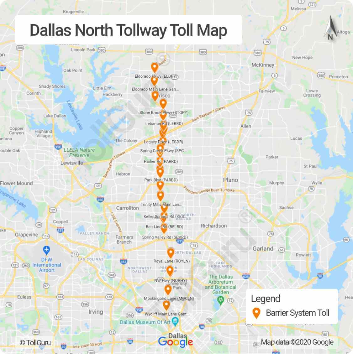
The Dallas North Tollway is a 30.2-mile limited-access toll road operated by the North Texas Tollway Authority (NTTA), which runs from Interstate 35E near downtown Dallas, Texas, to the U.S. Highway 380, in Frisco, Texas. This expressway connects motorists travelling between downtown Dallas and cities in Collin, Denton and northern Dallas counties passing through Highland Park, University Park, Addison, Farmers Branch, Plano and Frisco.
Tolls on Dallas North Tollway can be paid by TollTag while on the go and with NTTA ZipCash in case of missed tolls. The Tollway also accepts EZ TAG, TxTag, PikePass and K-TAG as well.
How do you pay for toll roads in Dallas
The DNT toll rates depend upon the vehicle category, plazas you cross and whether you pay with or without toll tag.
| Toll Road | Toll Plaza | TxTag Toll Rate (in USD) |
|---|---|---|
| Dallas North Tollway (DNT) | DNT South Toll Plaza | $0.86 - $6.72 |
| Dallas North Tollway (DNT) | Addison Airport Toll Plaza | $0.86 - $6.72 |
| President George Bush Turnpike (PGBT) | Bush Turnpike South Toll Plaza | $0.92 - $7.28 |
| Sam Rayburn Tollway (SRT) | Sam Rayburn Tollway Toll Plaza | $0.70 - $5.60 |
| Chisholm Trail Parkway (CTP) | All Plazas | $0.65 - $5.20 |
| Addison Airport Toll Tunnel (AATT) | Addison Airport Toll Tunnel Toll Plaza | $1.29 - $8.89 |
DFW International Parkway
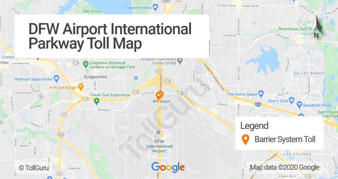
International Parkway provides access to Dallas/Fort Worth International Airport[3] (DFW) from the metropolitan area in the Dallas-Fort Worth Metroplex[4]. The DFW Airport toll plaza also handles parking fees for the DFW airport so consequently, you have to pay a toll to get to DFW airport.
How much is parking at DFW Airport with a toll tag
Because thousands of drivers cut through the DFW airport premises, so to discourage them a high toll is levied. This becomes clear with the DFW Airport parking toll fee for 0-8 min duration is more than that of for 8-30 mins.
| Time Spent in DFW | Toll Fee (in USD) |
|---|---|
| 0 min – 8 min | $6 |
| 8 min – 30 min | $2 |
| 30 min – 2 hrs | $3 |
| 6 hrs – 24 hrs | $24 |
Refer to the DFW Airport parking rate page[5] for more details.
How do I pay a toll at DFW Airport
You can pay at toll at DFW with a TollTag. If you don’t have TollTag, take separate lanes for cash/credit payment. Read more on payment methods and rates for DFW Airport on DFW website[6].
President George Bush Turnpike or PGBT
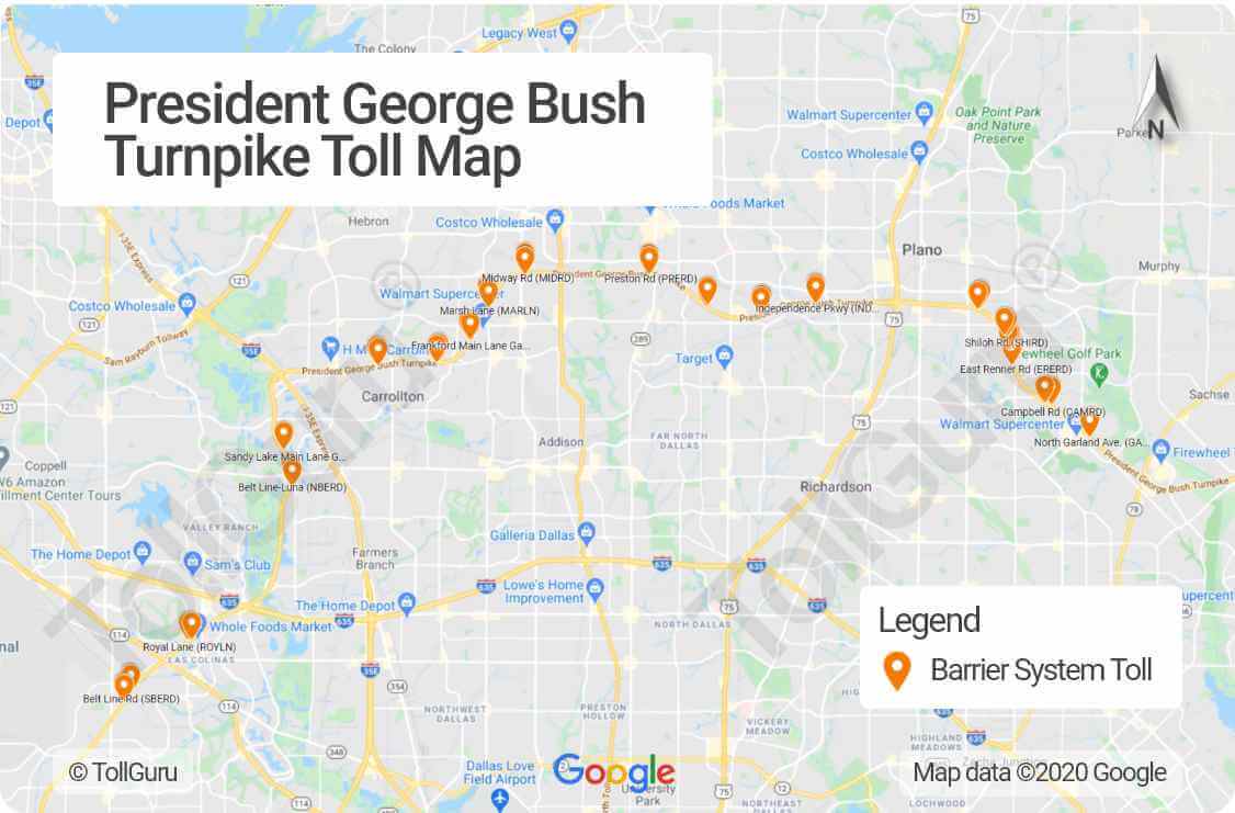
The President George Bush Turnpike, operated by the North Texas Tollway Authority (NTTA), is a 52-mile, limited access expressway that forms a partial loop around the northern Dallas-Fort Worth Metroplex. It gives motorists additional access to US 75, the Dallas North Tollway, Interstate 35E, I-635 and Dallas/Fort Worth International Airport as well.
Toll tags accepted on President George Bush Turnpike are TollTag, EZ TAG, TxTag, PikePass and K-TAG. If you don’t have any toll tag, you’ll get an invoice to use the turnpike by mail. You can Pay invoice using ZipCash either online[7], by mail, over the phone or in person.
For the latest toll rates of President George Bush Turnpike[8], visit NTTA.
President George Bush Turnpike-Western Extension or PGBT-WE
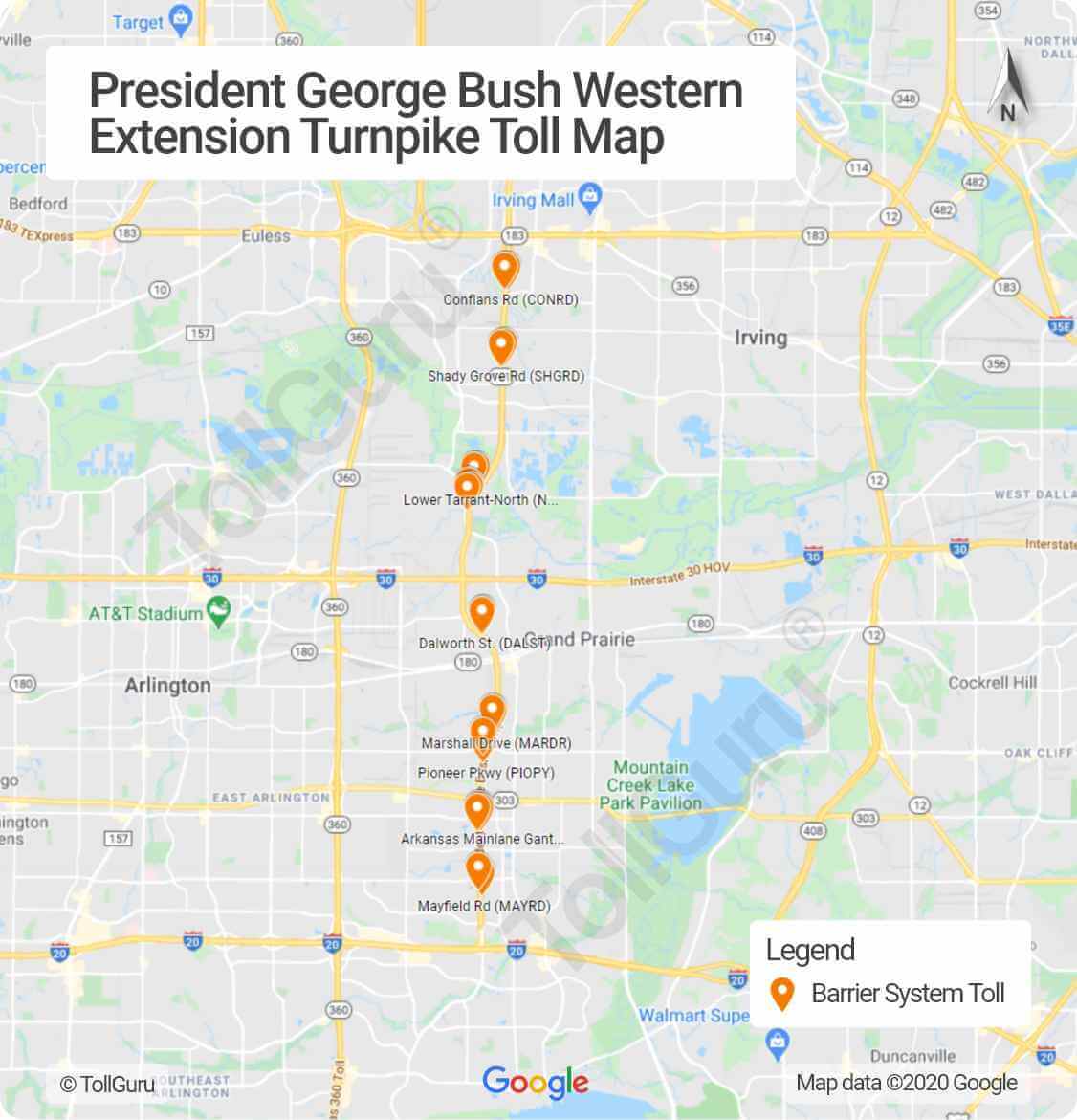
The western extension of President George Bush Turnpike provides an 11.5-mile link between SH 183, I-30, and I-20. The corridor consists of the tolled (cashless) main lanes, known as the Western Extension, and the frontage roads, called the State Highway (SH) 161. It is a part of the western loop around Dallas through Irving and Grand Prairie, just south of Dallas-Fort Worth (DFW) International Airport.
NTTA provides the latest toll rates of PGBT – WE[9].
President George Bush Turnpike – Western Extension or PGBT-WE accepts TollTag, EZ TAG, TxTag, PikePass and K-TAG. Missed tolls can be paid in various ways using ZipCash[10].
President George Bush Turnpike-Eastern Extension or PGBT-EE
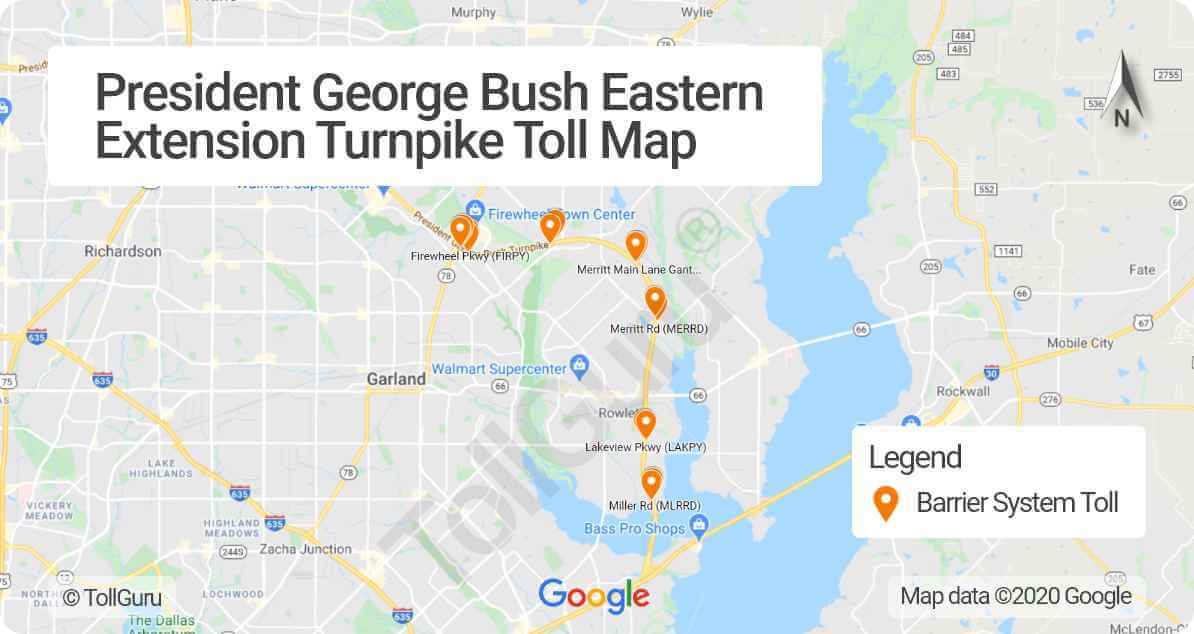
The Eastern Extension of the President George Bush Turnpike is a portion of the outer loop around Dallas and its suburbs that extends from northwest Garland to Interstate 30. It is part of the Loop 9 or the State Highway (SH) 190 corridor.
See the toll rates for various vehicles on PGBT EE[11].
Like President George Bush Turnpike, the Eastern Extension also accepts TollTag, EZ TAG, TxTag, PikePass and K-TAG. For missed tolls, you can pay the mailed invoice using ZipCash[12].
Sam Rayburn Tollway or SRT
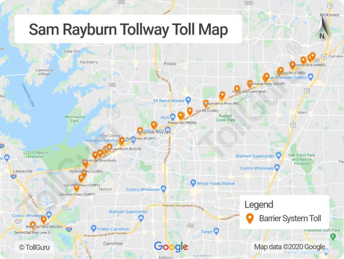
Sam Rayburn Tollway, a part of North Texas Tollway Authority (NTTA), runs from Grapevine to McKinney including the direct connector ramps at US 75, Dallas North Tollway, and I-35E. It was formerly known as State Highway (SH) 121, 121 Tollway or Texas 121 toll road.
To on Sam Rayburn Tollway you may use TollTag, EZ TAG, TxTag, PikePass or K-TAG. The missed toll can be paid online using ZipCash. Find the toll rates for various vehicles and gantries including Custer Road Main Lane Gantry on NTTA[13].
Chisholm Trail Parkway or CTP
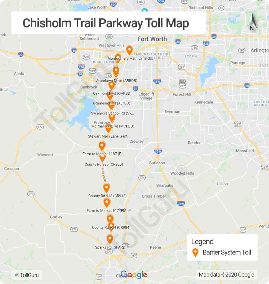
The Chisholm Trail Parkway is a 27.6-mile toll road extending from downtown Fort Worth south to Cleburne including Burleson. The entry and/or exit of the Chisholm Trail Parkway are at the following locations:
| I-30 near Summit Ave | Forest Park Blvd. | University Dr. / Montgomery |
| St. Edwards Ranch Rd. | Arborlawn Dr. | I-20 / SH 183 Interchange |
| Overton Ridge Blvd. | Oakmont Blvd. | Dirks Road / Altamesa Blvd. |
| Sycamore School Rd. | McPherson Blvd. | FM 1187 |
| CR 920 | FM 1902 / FM 915 intersection | CR 913 |
| FM 917 | CR 904 | Sparks Rd. |
| U.S. 67 |
See the Chisholm Trail Parkway speed limits for various stretches on NTTA [14].
How much is Chisholm Trail Parkway toll
The Chisholm Trail Parkway toll depends upon the toll plaza, vehicle axle count and the payment method- TollTag or ZipCash. The parkey also accepts EZ TAG, TxTag, PikePass or K-TAG. NTTA’s ZipCash is used for missed toll payments which charge up to 50% higher.
The tolls on the Chisholm Trail Parkway ranged from $0.34 for Sparks Rd toll gantry to $2.58 for $2.58 Stewart Feltz toll gantry for 2-axle car or motorcycle. Refer to the NTTA issued Chisholm Trail Parkway tolls[15] for more details.
Addison Airport Toll Road Tunnel or AATP
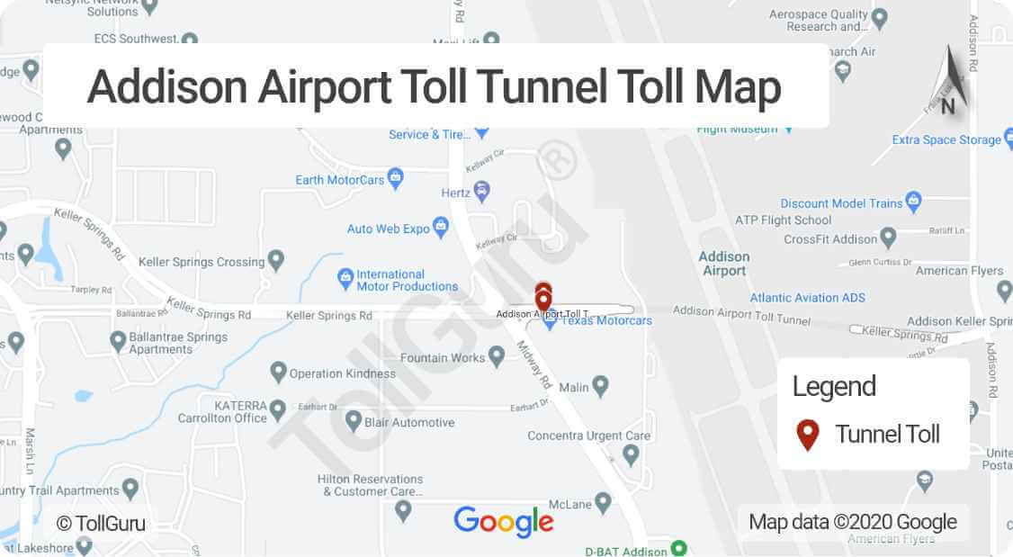
The Addison Airport Toll Tunnel (AATT) serves as an east-west route between the Dallas North Tollway and I-35E under the Addison Airport runway. The tunnel provides a passage on Keller Springs Road, which once ended on either side of Addison Airport, as an alternative to Belt Line Road or Trinity Mills Road.
TheAddison Airport toll road tunnel cost[16] varies for bikes, cars and other vehicles depending on their axle counts and mode of payment (whether through tag transponders or ZipCash). Tag transponders accepted on AATT are TollTag, EZ TAG, TxTag, PikePass or K-TAG.
Mountain Creek Lake Toll Bridge or MCLB
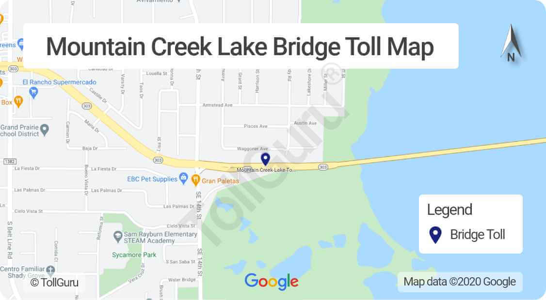
The Mountain Creek Lake Bridge (MCLB) provides a direct crossing of Mountain Creek Lake between the Oak Cliff section of Dallas and the City of Grand Prairie. The bridge is 7,425 feet long, with the full roadway extending 2.5 miles across the lake from the intersection of Spur 303 and Southeast 14th Street in Grand Prairie to the intersection of Spur 303 and Mountain Creek Parkway in Dallas.
Latest toll rates on MCLB[17]are provided by NTTA. MCLB accepts TollTag, EZ TAG, TxTag, PikePass and K-TAG. For missed toll, NTTA’s Zipcash is can be used.
Lewisville Lake Toll Bridge or LLTB
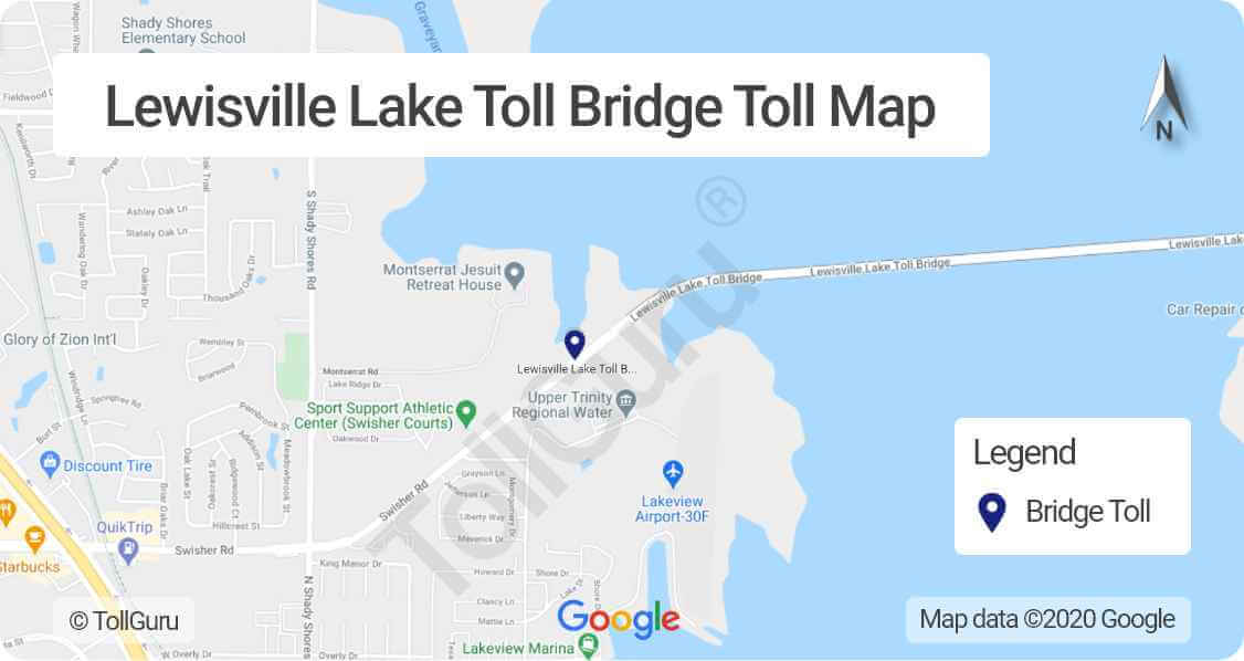
The Lewisville Lake Toll Bridge (LLTB) is a four-lane 1.7 mile bridge that connects Interstate 35 E (I-35E) at Swisher Road to the Dallas North Tollway at Eldorado Parkway. It provides an east-west connection to various destinations in Denton County.
Lewisville Lake Toll Bridge fee or toll rate are listed on NTTA website[18]. Tolls on LLTB are paid using TollTag, EZ TAG, TxTag, PikePass and K-TAG. NTTA’s ZipCash is used for paying missed tolls on LLTB.
HOV toll discounts on DFW TEXpress Lanes
In DFW, carpools, motorcycles and most vanpools who use the TEXpress Lanes are eligible for an HOV discount. To avail of discounts, you must have download and register at GoCarma app[19].
Who qualifies for HOV discounts on TEXpress Lanes
To qualify for HOV toll discount, you must have:
- at least two people in the vehicle, such as a driver and a passenger (motorcycles do not require a passenger)
- a valid and properly mounted TollTag, TxTag or EZ TAG account
The discount is valid during Monday – Friday, 6:30 a.m. to 9 a.m. and 3 p.m. to 6:30 p.m.
Refer to the HOV toll discount by TEXpress Lanes [20] for more details.
Calculate tolls for Texas and other states in the US
Calculate routes, tolls and fuel costs for your travel by car, truck, taxi, bus, caravans (with or without a trailer) in Texas and other states of the US using TollGuru Trip Calculator. It also shows the cheapest, fastest and other optimal routes to your destination along with toll plaza(s) location en route, payment methods and more.
Rideshare, OEM, TMS, fleet companies and other transport businesses can leverage toll intelligence by integrating with the TollGuru Toll API for pre-trip calculation and post-trip reconciliation.
FAQs
See also
References
- ↑ NTTA
- ↑ DFW Airport
- ↑ Dallas/Fort Worth International Airport
- ↑ Dallas-Fort Worth Metroplex
- ↑ DFW Parking Information
- ↑ DFW Airport parking payment
- ↑ NTTA toll payment
- ↑ PGBT toll rate
- ↑ PGBT – WE toll rates
- ↑ ZipCash payment
- ↑ PGBT EE toll rates
- ↑ ZipCash
- ↑ SRT toll rates
- ↑ Chisholm Trail Parkway speed limits
- ↑ Chisholm Trail Parkway tolls
- ↑ Addison Airport toll road tunnel cost
- ↑ MCLB toll rate
- ↑ LLTB toll rate
- ↑ GoCarma App for DEW
- ↑ HOV toll discount by TEXpress Lanes
